 Catchment Management
 The James Hutton Institute
This page is no longer updated. The Macaulay Land Use Research Institute joined forces with SCRI on 1 April 2011 to create The James Hutton Institute.
Allt a' Mharcaidh Catchment: Montane project
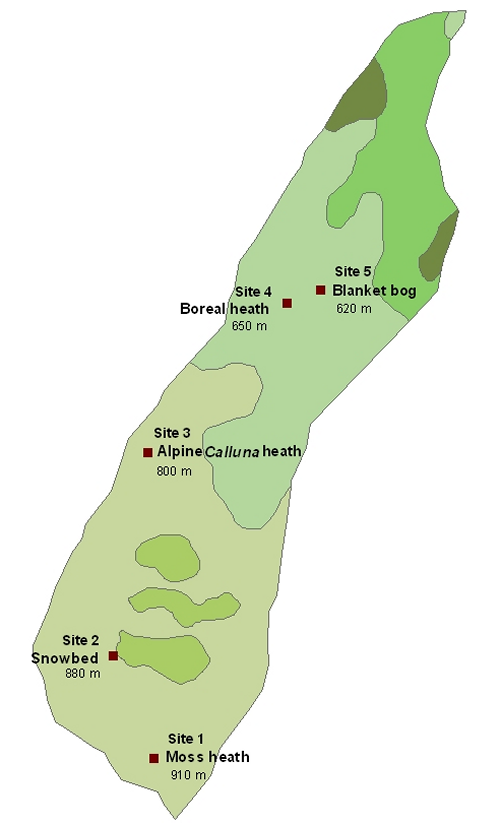
Sub-catchment vegetation map
The sequence of five monitoring sites in our chosen sub-catchment of the Allt a’Mharcaidh represents a typical gradient of alpine and upland vegetation types, running from Racomitrium-dominated moss heath on the mountain summit to blanket bog in the valley bottom. The communities along the gradient include the most widespread upland and alpine vegetation types in the UK. Sampling for
this project has focussed on
characterising
the nutrient pools in the vegetation
of the different communities, their
productivity and the return of nutrients
to the soil through litter decomposition.
For vegetation information move
the cursor over the
site
number and vegetation community.
|
Updated: 23 Jan 2024, Content by: RH
|