 Catchment Management
 The James Hutton Institute
This page is no longer updated. The Macaulay Land Use Research Institute joined forces with SCRI on 1 April 2011 to create The James Hutton Institute.
Allt a' Mharcaidh Catchment
Interception Deposition Chemistry
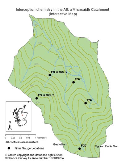
Click on map to enlarge
The quality and quantity of interception deposition is monitored at the site using ground level gauges with a column of interception mesh that is positioned on top of the gauge to collect mist and fog. Although both wet and dry deposition is collected by the interception gauge, it is generally accepted that in areas such as the Allt a’ Mharcaidh catchment, remote from emission sources, the dry deposition component of acid deposition is minimal. The location of the interception gauges represents differences in altitude, topography and aspect.
In 1990, the original experimental design was modified to account for an area of the catchment that was exposed, north facing and with no instrumentation. Filter gauges (FG2, 3 and 7) for monitoring interception deposition were positioned adjacent to three of the bulk deposition collectors (RG 2, 3 and 7). Following the completion of the deposition study in 1997 (monitoring at FG2 continued until 1998), all filter gauges at sites 2, 3 and 7 were removed.To access the data charts click on interactive chart or use the list below:
Analytical data were rejected from the study when there was evidence of contamination from birds (i.e. phosphate concentrations >0.5 mgl-1, potassium >0.2 mgl-1, nitrogen species >0.5 mgl-1). No observation was rejected as long as the sum base cations (Mg, Na, K, Ca, H, NH4-N) / sum of acid anions (SO4-S, NO3-N, Cl) was within a ± 10 % error for that individual sample
|
Updated: 23 Jan 2024, Content by: RH
|