 Catchment Management
 The James Hutton Institute
This page is no longer updated. The Macaulay Land Use Research Institute joined forces with SCRI on 1 April 2011 to create The James Hutton Institute.
Allt a' Mharcaidh Catchment
Ground water chemistry
 A ground water sampling programme was initiated in 1988-89 after 10 boreholes were installed using a portable Cobra drill. The boreholes (approximately 25 mm in diameter), were drilled through shallow podzolic and alluvial soils, which overlie undifferentiated glacial drift and alluvial deposits, respectively.
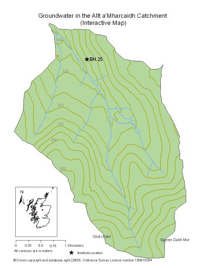
The boreholes which are generally 2-4 m deep, are arranged in two transects, almost 200 m long, that run perpendicular to the Allt a' Mharcaidh. Ground water levels within the boreholes were recorded at approximately weekly intervals using a hand held pump during September 1995 to June 1998. The most consistent dataset was collected from Borehole 25 (BH 25) which is located in a flat riparian zone that is incised at the base of a 14º slope. Data from this borehole is represented here - Groundwater Chemistry - borehole 25.
To access the data charts click on interactive chart or use the list below:
|
Updated: 23 Jan 2024, Content by: RH
|