 Catchment Management
 The James Hutton Institute
This page is no longer updated. The Macaulay Land Use Research Institute joined forces with SCRI on 1 April 2011 to create The James Hutton Institute.
Allt a' Mharcaidh Catchment: Montane project
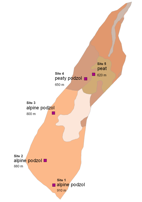
Sub-catchment soil map
The sequence of five monitoring sites in the Allt a' Mharcaidh sub-catchment represents the main soil types found in the catchment and their significant variants. The Alpine or Oroarctic podzols in particular have distinctive surface layers depending on whether they have formed under Racomitrium heath, in snow beds or on exposed terracettes (sites 1-3 respectively). At lower altitudes the soils are predominantly peaty podzols or deep peats.
For soil information move the cursor over the
site number and soil type.
|
Updated: 23 Jan 2024, Content by: RH
|