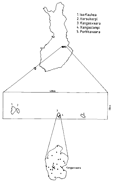
The Kangasvaara catchment (56 ha) in eastern Finland was used as the first test site. Data from four other nearby catchments were also used, together with Multisource National Forest Inventory data (25 x 25 m2) from an area of 10 x 40 km2. Multisource forest inventory data from the Finnish Forest Research Institute, including tree species, age and growth by tree species was based on Landsat TM- images and field measurements.
The area of catchments varied from 29 to 176 ha, the area of Kangasvaara being 56 ha. In terms of land use, virtually all of the land in the catchments was classified as forestry land. The main soil types in the catchments were thin, weakly developed iron podzols, peaty podzols and shallow fibric histosols (Sphagnum peat). The soils have developed on shallow (often < 2 m on hillslopes), stony to very stony till material. Further details of the Kangasvaara catchment can be found here.
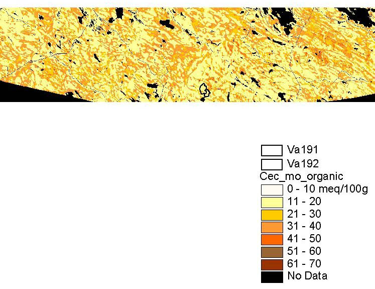
A new methodology of obtaining regional soil chemistry data as an input to GISSMART model was developed, combining empirical soil chemistry observations from five research catchments of the VALU-project and a 10x40 km Landsat TM image acquired on June 1982. The reference sample plot method by Finnish Forest Research Institute was used, also referred to as 'a k nearest neighbour fuzzy classification'. The plotwise accuracy of CEC and BS was estimated by the cross-validation method.
Estimated cation exchange capacity (CEC) in the organic layer (CEC_mo) in the 10 x 40 km2 area in Sotkamo-Kuhmo, eastern Finland.
Contact point e-mail: Juha.Kamari@vyh.fi or emir.bilaletdin@vyh.fi