Geoforensics and Information Management for crime Investigation (GIMI)
 Project Staff - Stuart Marsh
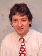
Dr Stuart Marsh
Head of Remote Sensing,
British Geological Survey,
Nicker Hill, Keyworth,
Nottingham, NG12 5GG,
United Kingdom
t. +44 (0)115 936 3452
f. +44 (0)115 936 3474
e. shm@bgs.ac.uk
w. www.bgs.ac.uk
Current Research Activities
Stuart Marsh is a remote sensing geologist and image analysis specialist with 15 years experience in their application to geoscience projects in many countries. He has managed the BGS remote sensing capability, staff and facilities since 1998. He has research interests in three areas: rapid, remote mapping techniques; the spectral measurement of minerals and gases; and the mitigation of geological hazards. He has been involved in rapid geological mapping projects throughout the UK and overseas since joining BGS in 1991.
He was heavily involved in developing the new BGS System for Integrated Geoscience Mapping. He developed satellite-based mineral mapping tools during a UK Department for International Development project Rapid Exploration for Building Materials in Egypt and Namibia during the early 1990s. He was then a Visiting Research Fellow at Tokyo University during 1996, where he extended this mineral mapping research to exploit the capabilities of the then-proposed ASTER satellite. He is now applying ASTER and airborne hyperspectral mineral mapping tools such as HyMap to the detection of mine waste in projects funded by BGS and the EC, like MINEO. He also leads the remote sensing activities in the EC FP6 Network of Excellence on Geological Storage of CO2, CO2GeoNet. During the 1990s, he formed part of a BGS team that developed Rapid Landslide Hazard Mapping techniques based on remote sensing for DFID. Subsequently, he was responsible for the ground motion element in an EC FP5 project, PRESENSE, aimed at designing a remote gas pipeline monitoring system.
He now leads the geological surveys and engineering companies in Terrafirma, a European Space Agency Service Element on ground instability within their Global Monitoring for Environment and Security Programme. He also co-chairs an international team implementing the Integrated Global Observing Strategy for Geohazards of the space and UN agencies. He sits on NERC’s Airborne Research and Surveying Facility Steering Committee and Earth Observation Expert Group. He is also Chairman of IUGS and UNESCO’s joint programme on the Geological Applications of Remote Sensing and Chairman of the UK’s Remote Sensing and Photogrammetry Society.
Recent Publications
Marsh, S.H. 2000. Remote mapping technologies for temperate, vegetated terrain. Keynote Paper, 14th ERIM Thematic Conference Proceedings, Las Vegas, NV, 11 – 18.
Jongmans, D., Pirard, E, and Marsh, S.H. (Eds.) 2001. GeoVision special publication, Computing and Geosciences, 27(9), 1018 - 1121. Including: Jongmans, D., Pirard, E, and Marsh, S.H. 2001. Geological applications of digital imaging, 27(9), 1015 – 1017.
Haynes, M., Culshaw, M. and Marsh, S.H. 2001. Remote monitoring of natural survey point networks – for precision surveying of structural and ground movements. Engineering Surveying Showcase 2001, 2, 22-24.
Chevrel, S., Kuosmanen, V., Groesel, K., Marsh, S., Tukiainen, T., Schaeffer, U., Quental, L., Vosen, P., Loudjani, p., Kuronen, E. and Aastrup, P. 2003. Remote sensing monitoring of environmental impacts. Mining Environmental Management, 11(6), pp 19-23.
Marsh, S.H. (Editor). 2004. The Integrated Global Observing Strategy Geohazards Theme Report. Integrated Global Observing Strategy Partnership. European Space Agency, 55pp.
Clark C. D., Evans D. J. A., Khatwa A., Bradwell T., Jordan C. J., Marsh S. H., Mitchell W. A., and Bateman M. D. (2004). Map and GIS database of glacial landforms related to the last British ice sheet. Boreas, 33 (4), 269-380.

