GIMI
GIMI
 The James Hutton Institute
This page is no longer updated. The Macaulay Land Use Research Institute joined forces with SCRI on 1 April 2011 to create The James Hutton Institute.
Geoforensics and Information Management for crime Investigation (GIMI)
Reduction of Search Areas
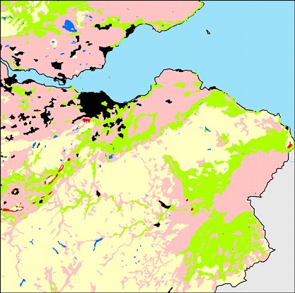
Based upon the matching of soil properties from case evidence, with soil maps and spatial databases, potential target areas for search can be identified. The onus is then on the soil forensic research team to obtain the crucial link between the legal investigation area and the geo-morphological evidence. Non-invasive soil property monitoring, such as through airborne or terrestrial remote sensing, allows a potentially rapid search of areas of interest.
Linking descriptions of soil characteristics from analytical and non-invasive sources with existing Geographic Information Systems (GIS) and associated databases of soils and vegetation enables areas of search to be geographically targeted. This can be done, for example, by identifying sites with a combination of soil and vegetation characteristics derived from analysis of evidence. Other geographic datasets (e.g. data on transport routes and population centres) can then be used in combination with those of soils and vegetation to explore hypotheses regarding worthwhile areas of search.
Example of techniques used to reduce the search area
Geographic Information Systems (GIS) layering