 GIMI
GIMI
 The James Hutton Institute
This page is no longer updated. The Macaulay Land Use Research Institute joined forces with SCRI on 1 April 2011 to create The James Hutton Institute.
Geoforensics and Information Management for crime Investigation (GIMI)
Project Staff - Heiko Balzter
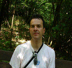 Dr. Heiko Balzter BSc, PhD.
University of Leicester
Department of Geography
Climate and Land Surface Systems Interaction Centre (CLASSIC)
Bennett Building
University Road
Leicester
LE1 7RH
UK
Tel: +44 (0)116 2523820
Fax: +44 (0)116 252 3854
Email: hb91@le.ac.uk
Current research activities
Heiko Balzter (Head of Department of Geography, University of Leicester), has expertise in earth observation techniques, ecological risk management, ecological process modelling and knowledge management (Balzter, 2005). He also has experience in land cover classification and forest mapping using radar and lidar remote sensing.
Publications
Balzter, H., Gerard, F.F., George, C.T., Rowland, C.S., Jupp, T.E., McCallum, I., Shvidenko, A., Nilsson, S., Sukhinin, A., Onuchin, A. and Schmullius, C. (2005): Impact of the Arctic Oscillation pattern on interannual forest fire variability in Central Siberia, Geophysical Research Letters 14, doi:10.1029/2005GL022526
Balzter, H., Skinner, L., Luckman, A., and Brooke, R. (2003): Estimation of tree growth in a conifer plantation over nineteen years from multi-satellite L-band SAR. Remote Sensing of Environment 84, 184-191.
Balzter, H., Talmon, E., Wagner, W., Gaveau, D., Plummer, S., Yu, J.J., Quegan, S., Davidson, M., Le Toan, T., Gluck, M., Shvidenko, A., Nilsson, S., Tansey, K., Luckman, A. and Schmullius, C. (2002): Accuracy assessment of a large-scale forest map of Central Siberia from Synthetic Aperture Radar. Canadian Journal of Remote Sensing 28, 719-737.
Gerard, F., Plummer, S., Wadsworth., R., Ferreruela, A., Iliffe, L., Balzter, H. and Wyatt, B. (2003): Forest fire scar detection in the boreal forest with multi-temporal SPOT-VEGETATION. IEEE Transactions on Geoscience and Remote Sensing 41, 2575-2585.
Gerard, F.F. 2002. Single and dual angle viewing, multi-temporal viewing: assessing the implications for forest structure parameter extraction through modelling. International Journal of Remote Sensing.
Gerard, F., Plummer, S. North, P. & van Rooyen, A. 2001, Natural resource in Southern African drylands: determining spatial availability and variability using ATSR2 time series. First International Workshop on the Analysis of Multitemporal Remote Sensing Images, Trento,13-14 Sept. 2001.
Onuchin, A., Balzter, H., Borisova, H. and Blyth, E., 2005 in press, Climatic and Geographic Patterns of river-runoff formation in Northern Eurasia, Advances in Water Resources