 DeerMAP
 The James Hutton Institute
This page is no longer updated. The Macaulay Land Use Research Institute joined forces with SCRI joined forces on 1 April 2011 to create The James Hutton Institute.
 This page has been mothballed.
It is no longer being updated but we've left it here for reference.
DeerMAP - How does DeerMAP work?
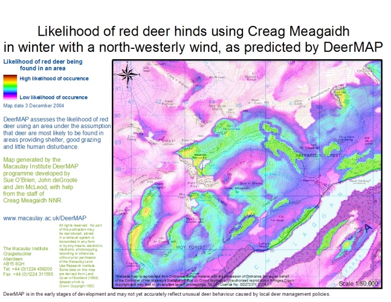
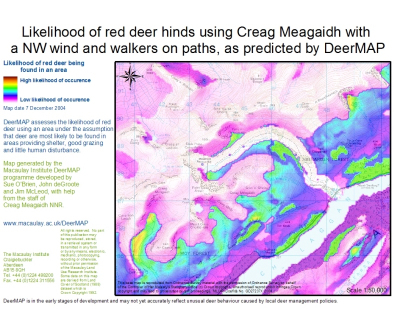
DeerMAP uses information drawn from the literature and the expert knowledge of deer managers to predict where deer are most likely to be.
Within a GIS (Geographical Information System) environment, the user:
- ranks habitats within the mapped landscape in order of feeding preference of red deer (we actually provide a default ranking so the user only has to adjust the model’s habitat ranking to suit their own view)
- defines the season and weather conditions (wind direction, snow cover)
- defines areas of human disturbance (hill walkers and stalking)
Using a digital elevation model and land cover data, DeerMAP then highlights areas on an Ordnance Survey map where deer are most likely to be found: the areas of best feeding, least human disturbance and most shelter (in winter).
It will simulate regenerating native woodlands, based on a site suitability assessment from the Macaulay Native Woodland Model.
DeerMAP will be tested against data from GPS collars on red deer in the Highlands and dung count data from several locations.
DeerMAP uses land cover data to identify areas offering shelter and food.
Topography based on the Ordnance Survey 1:50 000 Landranger maps, with the permission of Her Majesty's Stationery Office. © Crown Copyright Ordnance Survey Licence Number GD27237X 2004.
Note:
DeerMAP is in the early stages of development and may not yet accurately map unusual deer behaviour caused by the local deer management policy.