GIMI
GIMI
Geoforensics and Information Management for crime Investigation (GIMI)
Network Activities
Four sub-groups will be tasked with developing reviews of the current status of geoforensics with respect to their specific interest, as listed below, with the aim of recommending actions by partners or the production of limited feasibility activities.
Sub-Group 1 Forensic group
Coordinators: Alastair Ruffell (Queens University ) and Lorna Dawson (MI)
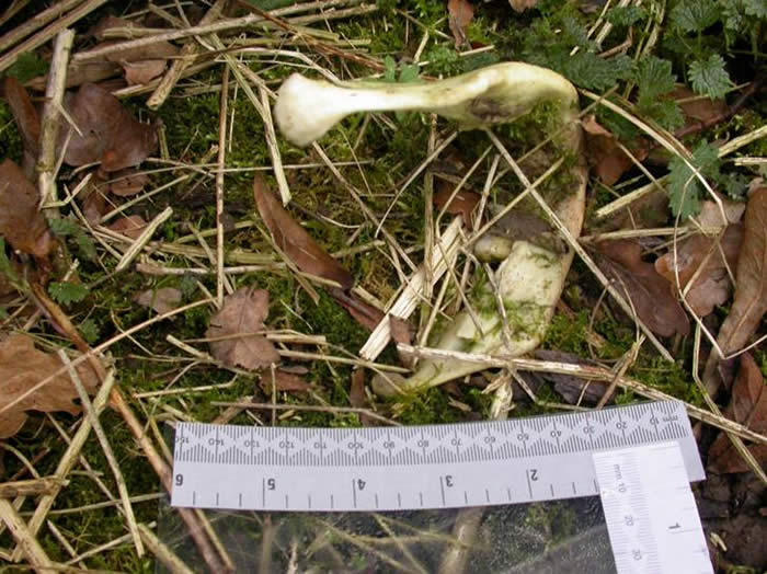
This sub-group will have the principal responsibility for identifying the user requirements with respect to the provision of forensic evidence, and evaluating the feasibility of materials and proposals from the other sub-groups.
Membership of this SG will comprise representatives from the NCPE, Queens University NI, the University of Bradford, legal representatives, Police forces, the Forensic Science Service, The Police Forensic science Laboratories, the Robert Gordon University, the University of Dundee, the University of Edinburgh, the University of Western Australia, the University of Aberdeen, MI, CAFSS, ISEF, ESR New Zealand, the Police Service NI, Gardai (R Ireland), BGS and the University of Birmingham.
Its role will be to:
- Set priorities for end user requirements, validation criteria and assessment of geoforensic tools, thus informing the programme of activities of each sub-group.
- Set credible scenarios of crime scenes for development of feasibility materials.
- Create links with stakeholder programmes of training and development.
- Prioritise recommendations for the submission of research and development proposals for external funding.
- Identify opportunities and needs for the dissemination of network outputs amongst user communities.
Sub-Group 2 Analytical activities: soil, sediment and vegetation properties group
Coordinators: Lorna Dawson (MI) and Colin Campbell (MI)
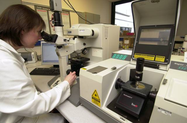
This sub-group will have responsibility for assessing the use and range of potential methods suitable for identifying sites and linking this information to the current and projective data bases.
Membership of sub-group 2 will comprise representatives from the MI, NSRI Cranfield University, DARDNI, the University of Western Australia, ESR New Zealand, ISEF, Queens University NI, CAFSS, the International Peat society and BGS.
Its role will be to:
- Integrate outputs from current research projects of the network, and outside, including EP/C528786/1(P), on novel biological, chemical and physical -based technologies for forensic measurements, with end user requirements set by sub-group 1.
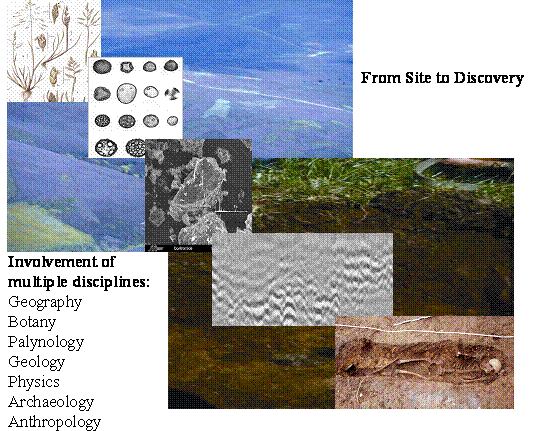
- From (i) above, link the analytical measurements with interpretation of the characteristics of soils, peat, sediments and vegetation as represented in existing databases, linking with sub group 4.
- Identify gaps in the current databases that would hinder use of matching analytical data with spatial and novel means of data extraction from images.
Sub-Group 3 Signal processing and instrumentation group
Coordinatiors: Parivash Lumsdon (MI) and Iain Woodhouse (UoE)
This sub-group will consider the options for non invasive methods, particularly under what is currently deemed as difficult conditions.
Membership of sub-group 3 will comprise representatives from MI, Queens University Belfast, the University of Edinburgh and CEH Centre for Earth Observation, Robert Gordon University, the University of Bradford, and BGS.
Its role will be to:
- Address issues on instrumentation requirements and functionality of non invasive instruments, data acquisition, image processing and data extraction, algorithm prioritisation and validation, algorithm reassessment, and recommendation on the requirements of user friendly software and its suitability for the system information management
- Application focus on identification of physical features, vegetation and soil classification, and sub surface soil profiles for peat and soils with high moisture contents.
Sub-Group 4 Software, databasing and communications group
Coordinatiors: David Miller (MI) and Mark Brewer (BioSS)
This sub-group will be responsible for assessing the analysis/methods linking the various related databases and developing robust statistics and visualisation methods.
Membership of sub-group 4 will comprise representatives from the MI, BioSS, the University of Edinburgh, NCPE, the Police Service NI, Gardai (R Ireland), BGS, the Police Forensic science Laboratory Dundee, NSRI, BioSS, DARDNI, and the University of Western Australia. Its role will be to consider issues of:
- Information management in relation to techniques for matching analysis of samples to characteristics of soils and vegetation held within existing databases, and identifying gaps in data that would require future investment.
- Database links to enable the use of forensic measurement/ knowledge-based interpretation of content (linking with sub-group 2 and sub-group 3), and presentation of results using data visualisation media.
- User interfaces to database and analysis tools, the nature and training of users for effective employment of existing materials, and a programme of development of software and database requirements, for inclusion in proposals for external funding.
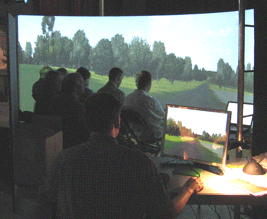
- Information provision to sub-group 1, including means of representation and presentation of sub-surface data for expert interpretation, using state-of-the-art virtual reality tools, and communicating such information to legal teams.
- Development of statistical tools for matching samples and for compositional analysis, taking into account data from multiple sources, and integration to projects EP/C532627/1(P), GR/S63267/02 and GR/S98603/01(P).